

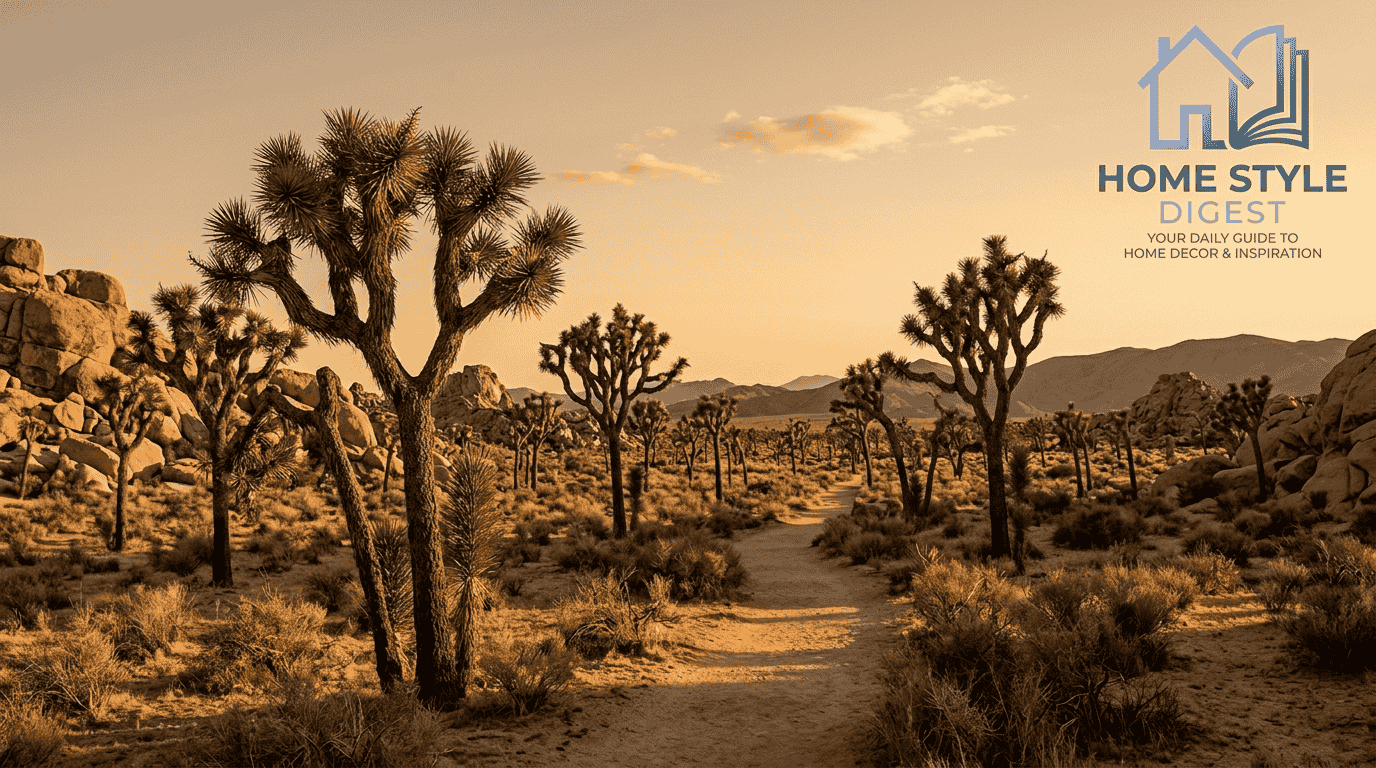
California arid landscape spans arid landscapes and dryland environments across North America, where deserts, mountain ranges, dry valleys, salt flats, dunes, and desert ecosystems persist under limited rainfall and high evaporation today across the state.
- What Makes California Arid Landscape Unique?
- What Defines An Arid Landscape?
- Major Arid Regions Of California
- Mojave Desert
- Death Valley
- Joshua Tree National Park
- Anza-Borrego Desert
- Desert Vegetation And Plant Adaptations
- Climate Change And Drought Effects On California Arid Landscapes
- Desert Soil And Biological Crusts
- Geological Features Of California Arid Landscapes
- Wildlife In California Desert Ecosystems
These temperature extremes influence geological formations and diverse ecosystems across dry environments, requiring specialized survival strategies throughout desert regions while maintaining remarkable ecological complexity among resilient plant communities and wildlife habitats through seasonal shifts locally.
Field study highlights unique geological features such as dry washes, cliffs, canyons, sand dunes, and alluvial fans, while extreme heat, drought, and scarce water availability continually reshape ecological conditions across the landscape over long periods.
I treat this terrain as interconnected rather than barren: weather controls moisture, geology redirects runoff, vegetation captures brief opportunities, and animals adjust behavior. That perspective explains why California’s driest areas remain ecologically active and varied.
What Makes California Arid Landscape Unique?
California’s arid landscape is shaped by deserts, mountain ranges, and dry valleys, where limited rainfall meets high evaporation. These conditions create dry environments supporting specialized ecosystems across remarkably varied regions throughout California.
The state’s salt flats, dunes, dry washes, and canyons reveal how water and erosion interact despite scarcity. Meanwhile, plant communities and wildlife habitats demonstrate specialized survival strategies developed under persistent environmental pressure.
Across these desert regions, temperature extremes, drought, and scarce water availability influence ecological patterns. Yet geological formations, alluvial fans, and cliffs create localized conditions where diverse species can survive and reproduce successfully.
From a practical landscape perspective, California’s aridity is not simply about dryness. It reflects interacting climate, geology, and biology, producing desert ecosystems with distinctive structures, resource limitations, and ecological complexity across the state.
What Defines An Arid Landscape?
An arid landscape begins with low rainfall and high evaporation, creating limited water availability that supports sparse vegetation. In practice, moisture balance matters more than rainfall alone when defining California’s driest environments across the state.
Specialized vegetation persists where deserts, arid ecosystems, and semi-arid lands receive irregular precipitation. Rates of evaporation and transpiration determine whether available moisture remains accessible to roots, leaves, and soil organisms after brief storms quickly there.
Researchers classify dryland climates as hyper-arid, arid, semi-arid, or sub-humid, depending on moisture availability. Rain-shadow effects behind mountain ranges can intensify extremely dry conditions, even within relatively compact geographic areas in inland areas today often.
The useful field indicators are annual rainfall, desert climate, and water scarcity together. I usually examine vegetation density, soil moisture, and runoff patterns because those measures reveal aridity more reliably than temperature alone for accuracy.
Major Arid Regions Of California
Across California, arid regions occur as contrasting desert regions, with distinct ecosystems and landscapes shaped by elevation, drainage, and climate. Protected areas preserve representative terrain where ecological processes remain visible across inland California today now.
Large mountains divide interior valleys, exposing contrasting geological formations and creating sharp transitions between relatively moist slopes and extreme environments. These boundaries influence where native species, plant communities, and wildlife habitats persist across interior basins.
Local field conditions change quickly under drought conditions and dry climates, yet organisms display desert adaptation. I have found that comparing neighboring basins often reveals more nuance than treating California’s deserts as one uniform region.
The strongest regional framework therefore considers geology, elevation, exposure, and water movement together. Mojave terrain differs substantially from coastal-influenced desert margins, while protected landscapes conserve specialized communities adapted to recurring dryness and heat during surveys.
Mojave Desert
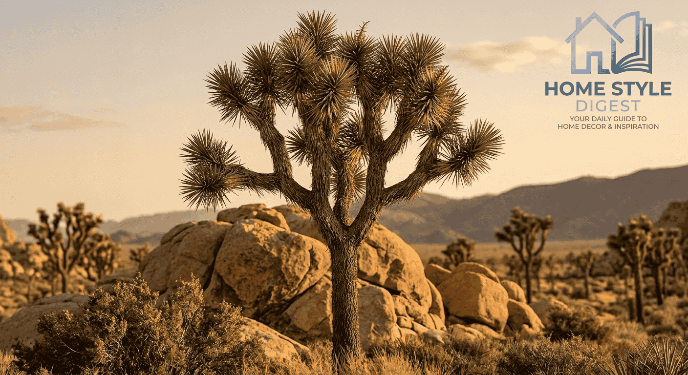
The Mojave Desert functions as a high desert ecosystem where elevation changes produce striking extreme temperatures and unique vegetation. The Joshua tree serves as an indicator species, reflecting broader shifts within the desert ecosystem today.
Across its geological features, isolated peaks, dry washes, cliffs, and canyons create different exposure and runoff conditions. Lower surfaces may collect sediment, while steep terrain interrupts water movement and concentrates brief seasonal flows briefly there.
Salt pans, dunes, and alluvial fans add further habitat variation, supporting specialized plant species and animal species despite harsh desert conditions. These landforms also help explain why neighboring sites can look ecologically unrelated locally often.
Fieldwork repeatedly shows drought adaptation is not one strategy. Plants alter growth timing, animals shift activity hours, and communities exploit shaded microsites. The Mojave’s apparent uniformity therefore hides many fine-scale survival responses across exposed terrain.
Death Valley
Death Valley is an extreme desert environment recognized as the hottest location and among the driest environment conditions in North America, while its lowest elevation contributes strongly to intense heat accumulation during summer most years.
As a national park spanning millions of acres, it contains salt flats, mountain ranges, and broad valleys. Rapidly changing elevation zones create ecological transitions that can occur over surprisingly short distances locally.
Some basins sit near sea level, yet surrounding slopes support distinct ecological communities with specialized plant species and animal species. The barren landscape appearance therefore conceals active biological responses to severe climatic stress seasonally today.
Observed survival strategies vary with shelter, timing, and access to scarce moisture. Under extreme conditions, organisms exploit narrow opportunities, making Death Valley an unusually useful setting for studying desert resilience and physiological limits locally observed.
Joshua Tree National Park
Joshua Tree National Park joins desert ecosystems from the Mojave Desert and Colorado Desert, producing sharp ecological contrasts. Higher elevation zones differ from lower elevation basins in temperature, moisture, and vegetation structure across park today.
Joshua trees dominate recognizable desert vegetation, yet surrounding geological formations create sheltered pockets where other species persist. Their distribution reflects water balance, soil conditions, exposure, and the timing of favorable seasonal weather across exposed terrain.
Researchers often describe drought survival strategies through plant adaptation, including dormant periods that reduce metabolic demand. Some species retain seeds until sufficient rainfall improves growing conditions, allowing brief bursts of establishment after brief winter storms.
This pattern demonstrates ecosystem resilience without implying unlimited recovery. In my observations, resilience depends on repeated opportunities for regeneration, because prolonged dryness can interrupt recruitment even when mature plants appear stable for years stress.
Anza-Borrego Desert
Anza-Borrego Desert presents broad arid landscapes where mountain areas, rock formations, and sculpted badlands intersect. Drainage from higher ground spreads across bajadas, creating shifting surfaces that respond strongly to brief rainfall after intense storms locally.
Seasonal desert washes connect slopes and basins, carrying sediment while exposing patches suitable for native plant species. These corridors are temporary, yet they influence germination, forage availability, and local movement during favorable weather after rain.
Within desert scrub communities, the creosote bush often dominates dry flats, while palo verde, cactus, and ocotillo vegetation occupy different microsites. Their spacing reflects water competition, exposure, soil texture, and disturbance history across open desert.
The resulting desert flora is neither random nor uniformly sparse. Experienced observation shows that small changes in slope, runoff, and substrate can reorganize vegetation patterns across surprisingly short distances within Anza-Borrego during field surveys today.
Desert Vegetation And Plant Adaptations
Desert vegetation reflects precise plant adaptations to extreme dryness, where survival strategies often include deep root systems that reach underground water. Root architecture can matter as much as visible foliage during prolonged dry periods California.
Some species emphasize water storage, while others emphasize reduced water loss through leaf structure, seasonal dormancy, or altered gas exchange. The creosote bush, mesquite, and Joshua trees demonstrate different solutions to the same moisture constraint California.
Saltbush displays strong drought tolerance, yet desert growth remains sensitive to precipitation variability. Brief rainfall events can trigger rapid plant growth, especially where soil conditions allow temporary biological activity and successful establishment across basins today.
Timing is critical for seed germination because moisture may disappear quickly. Experienced field work shows desert plants often succeed through flexible responses rather than constant productivity, conserving resources until conditions become favorable again wet seasons.
Climate Change And Drought Effects On California Arid Landscapes
Climate change is altering California arid landscapes through rising temperatures and greater precipitation variability. These shifts can modify vegetation cover, timing of rainfall, and the duration of moisture windows available to desert organisms inland regions.
Observed drought effects become more consequential when ecosystem stability is already constrained. Persistent drought conditions reduce water availability, compressing resources within wildlife habitats and increasing competition among organisms sharing limited seasonal opportunities across desert areas.
Longer dry intervals can elevate wildfire risks, especially where invasive or accumulated fuels interact with heat. During extreme drought, native species may face reduced recruitment, altered food webs, and fewer refuges from sustained environmental stress.
The central concern is ecosystem survival through prolonged dry periods and accelerating environmental changes. In practice, monitoring vegetation, water, fire, and wildlife together gives a more useful picture than tracking temperature alone during field monitoring.
Desert Soil And Biological Crusts
Desert soil often appears inactive, yet biological soil crusts contain microorganisms including algae, fungi, lichens, and mosses. Together they occupy the soil surface, influencing stability, infiltration, and nutrient availability across dry basins in California locally.
These communities contribute to erosion prevention by binding loose particles, while supporting nutrient cycling within dryland ecosystem functions. Their influence can be subtle, but repeated disturbance may remove benefits that recover slowly across exposed landscapes.
Because crusts occupy fragile environments, their disturbance sensitivity matters during recreation, grazing, construction, and vehicle use. A single damaged patch can expose soil to wind and runoff, changing surface conditions beyond the original footprint locally.
Effective desert protection therefore includes limiting unnecessary surface disturbance and recognizing crusts as living infrastructure. From field experience, healthy crust development can indicate relatively stable ground, while broken surfaces often signal ongoing erosion risk gradually.
Geological Features Of California Arid Landscapes
California arid landscapes are strongly controlled by geological features, from salt flats and sand dunes to steep canyons. Their shapes record erosion, sediment movement, tectonic uplift, and changing drainage across arid basins across interior today.
Ancient dry lake beds preserve clues about former water regimes, while mountain ranges feed sediment into adjacent lowlands. Alluvial fans commonly spread outward from canyon mouths, recording episodic runoff and sediment deposition during intense storms.
Distinct rock formations expose layers that help explain desert geology, including resistant surfaces, fractured slopes, and softer deposits. These contrasts produce recognizable landforms that influence shade, runoff, soil depth, and habitat distribution across desert terrain.
In practical mapping, natural formations are more than scenic landmarks. Their orientation and material properties affect water pathways and biological refuges, so geological reading remains essential when evaluating California’s arid terrain at site scale locally.
Wildlife In California Desert Ecosystems
Wildlife in California desert ecosystems includes reptiles, mammals, birds, and insects, each occupying different thermal and resource niches. Their distribution reflects shelter, food timing, predator pressure, and the availability of temporary water across inland regions.
Many desert species rely on survival adaptations that reduce exposure to heat, including behavioral shifts and efficient water use. Heat tolerance can determine when an animal forages, rests, moves, or retreats underground during summer extremes.
Where limited water constrains activity, organisms track seasonal resources such as flowering plants, insects, seeds, or short-lived pools. These temporary opportunities can reorganize local interactions and influence reproductive timing across desert habitats after rainfall events.
Maintaining ecological balance depends on functioning desert habitats rather than any single species. In field observation, small changes in vegetation or water timing can quickly alter wildlife presence, activity patterns, and community interactions seasonal surveys.